
01
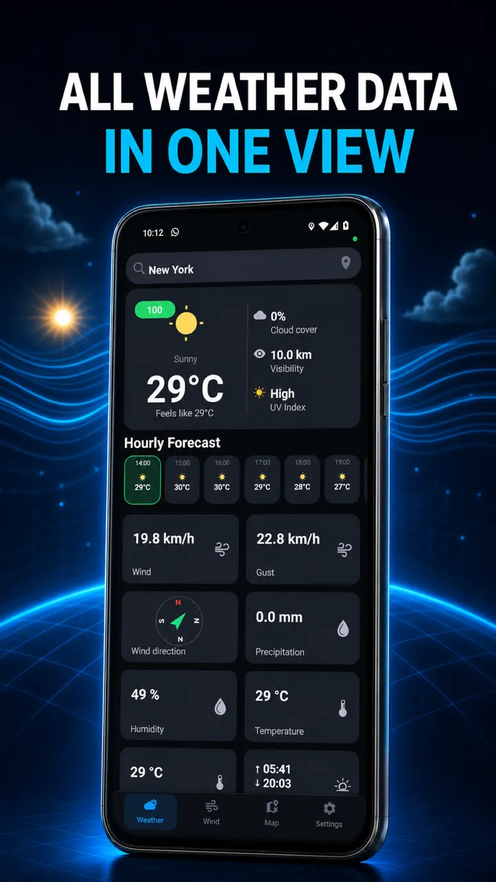
Hourly weather forecast
Explore hourly conditions, precipitation, visibility and cloud cover for your selected location.
WEATHER INTELLIGENCE FOR DRONE PILOTS
Hourly drone weather for Android. Check rain and visibility, then explore wind at altitude and no-fly zone map layers with Premium before planning a flight.
For Android · Free access + Premium
Illustrative app screens · English interface · Example data
01 / Features
Explore hourly conditions, precipitation, visibility and cloud cover for your selected location.
Compare forecast wind speed and direction at different heights. Keep gusts in view, too.
Weather analytics bring trends together so you can compare possible times for your next shoot.
Explore map layers and zone information. Coverage depends on the source; verify current restrictions with the relevant authority.
The app includes checklist functionality. Use our browser checklist to prepare, add your own items and print a copy.
Before the propellers turn
Check the forecast for your destination before packing.
Compare wind at different heights, not just near the ground.
Review changing conditions across the hours you plan to film.
Work through your equipment and location checks.
THE APP IN MOTION
From the forecast to the map. See the real interface, switch sections and follow each interaction.
Zoom into the area, open marker information cards and select the categories you need in the map filters.
Actual screen recording · English interface · Data as recorded
Open video ↗Explore map layers and zone information. Coverage depends on the source; verify current restrictions with the relevant authority.
02 / App screens
Illustrative app screens · English interface · Example data
Explore hourly conditions, precipitation, visibility and cloud cover for your selected location.
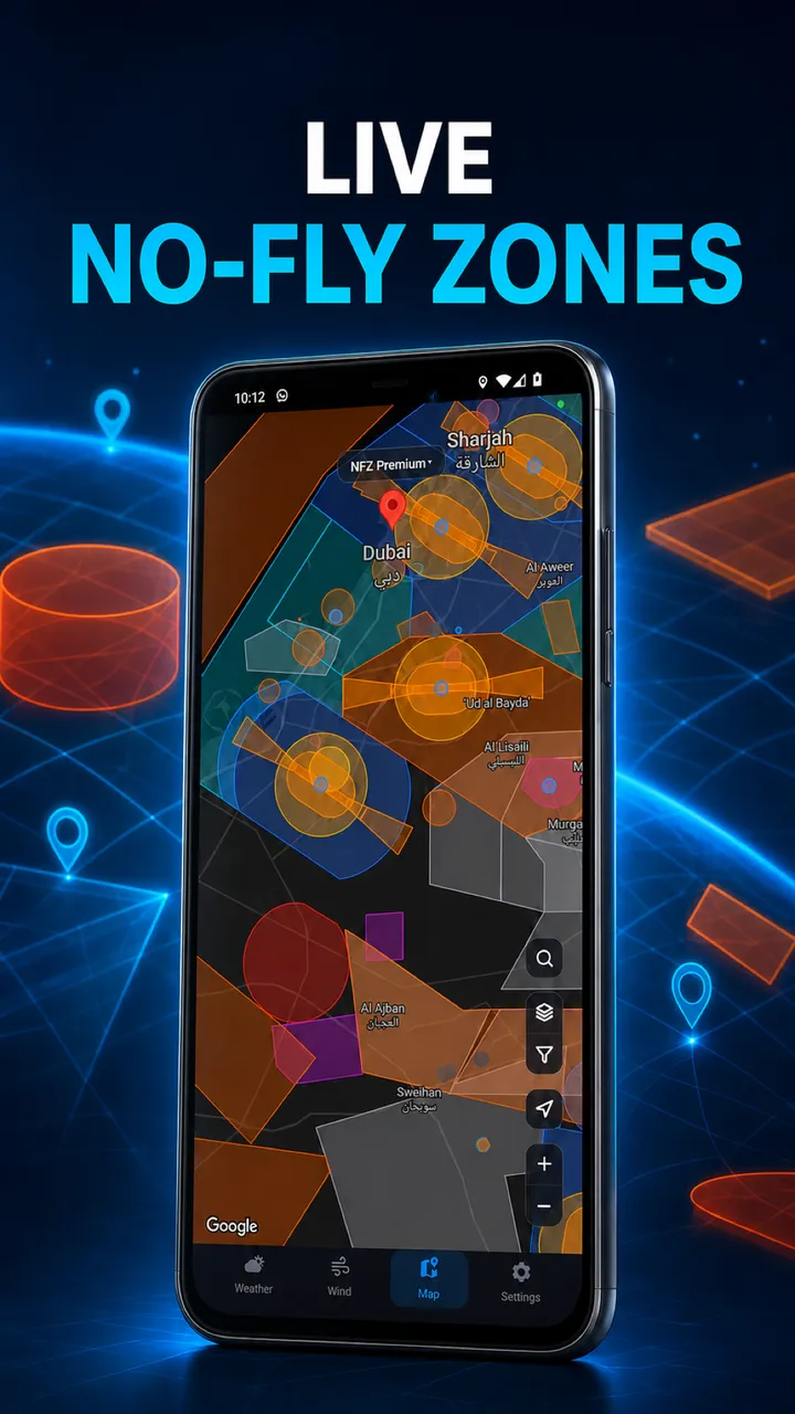
Zoom into the area, open marker information cards and select the categories you need in the map filters.
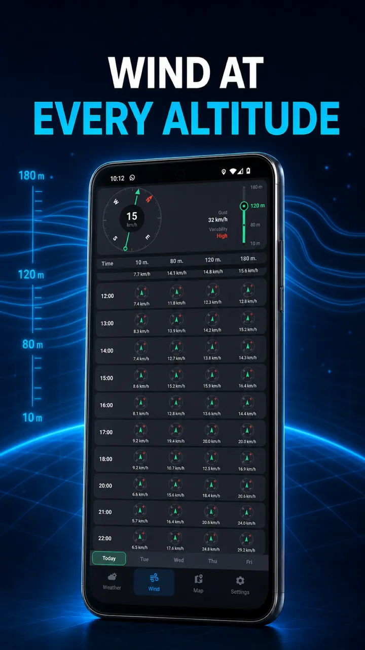
Compare forecast wind speed and direction at different heights. Keep gusts in view, too.
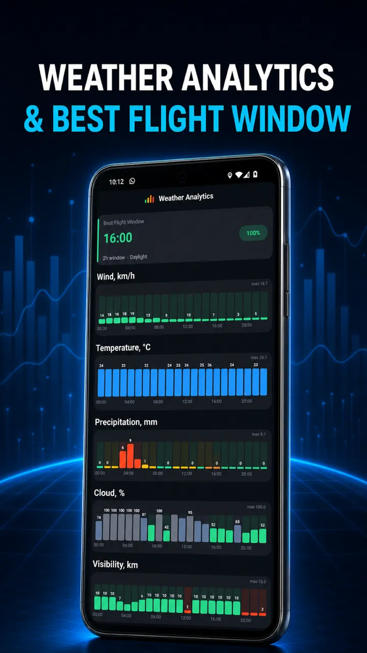
Weather analytics bring trends together so you can compare possible times for your next shoot.
03 / Get started
Open Weather and use the location button. Allow location access for GPS and check the selected place. Manual location search is a Premium feature. Choose your destination there when available.
In Settings, select your drone profile and preferred units. Return to Weather and compare hourly conditions, precipitation and visibility for the period you have in mind.
Open Wind and compare the displayed heights, direction and gusts. Then open Map to inspect the area and available layers. Review official restrictions and your checklist before departure. The Wind screen requires Premium.
04 / Free access + Premium
Free access lets you explore the app. Premium opens more planning detail. Check the current offer in the app before subscribing.
Main weather, a forecast request for three days, the basic map and settings. The data available can depend on the provider.
Five-day forecast requests, wind at 10, 80, 120 and 180 metres, weather analytics, Premium map layers and manual location selection. Check the app for current subscription terms.
05 / Flight tools
Compare the same wind speed in metres per second, kilometres per hour, miles per hour and knots. This converts units; it does not set a safe flight limit.
A personal preparation aid. Adapt it to your aircraft manual, location and flight. Progress is saved only in this browser when storage is available.
FAQ
Answers about Drone Forecast for Android: weather forecasts, wind at altitude, map coverage, free features, Premium subscriptions and app support.
Drone Forecast — Mobile Assist is an Android weather and flight preparation app. It combines weather, wind at altitude, analytics, maps and checklist functionality for drone pilots.
This website and its tools work in a browser. The app linked here is the Android edition on Google Play. Check that listing for device and regional availability.
Open Settings in the app. Select the drone profile and the units you prefer, then return to Weather or Wind to read the forecast in that context.
The app combines weather forecasts and geographic information for flight planning. Forecasts are model output, not measurements at your aircraft. Check the selected place, forecast time and actual conditions on site.
Take the weather, wind and your preparation with you.